The Mexican-American War and United States Expansionism
✶
Maps commissioned by the United States Army during the Mexican-American War demonstrate the United States’ territorial ambitions within Mexico in the aftermath of the U.S. annexation of Texas. These maps, created in 1847, depict respectively a wide swath of Mexican territory with a focus on central and eastern Mexico, as well as a detailed map of the Battle of Churubusco.
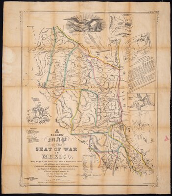
The former purports to be a “corrected” version of Mexican General Mariano Arista’s map, emphasizing the United States’ capture of Monterrey and featuring a narrative about various battles. Casualties for the U.S. army describe “12 killed and 350 wounded,” while casualty totals for the Mexican army describe “800 killed and wounded,” thus further creating an image of U.S. military supremacy by obfuscating the comparable metrics. The map fades out before reaching the Gulf of California, indicating the geopolitical focus on the Gulf of Mexico as a means of expanding United States influence across Mexico, and later, the rest of Latin America.
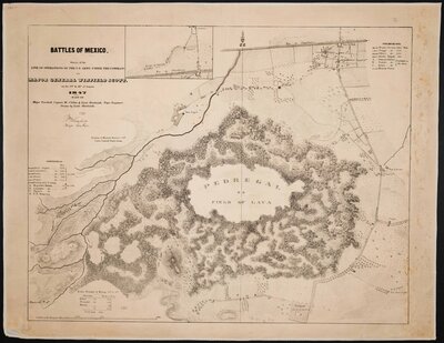
The map of Churubusco, titled “Battles of Mexico,” has an unusual design centered largely on the Pedregal, a lava field. The grand scale of this natural feature makes U.S. troop positions around the Pedregal seem miniscule in comparison, perhaps an unintentional gesture towards portraying what U.S. soldiers may have seen as an unusual, alien landscape.