Colonizing Tenochtitlán
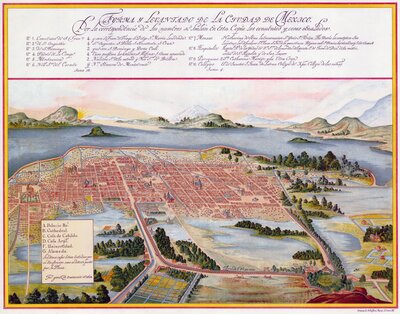
Perspective map of Mexico City before the drainage of Lake Texcoco by Juan Gómez de Trasmonte, 1628. Causeways with aqueducts served as the city's arteries connecting the islet to the mainland.

Before Mexico City, there was Tenochtitlán—the capital of the Nahua Triple Alliance (Aztec) empire. Extant Indigenous histories retell the origin story of this metropolis as an odyssey that culminated in a prophetic moment. Coming from an island named Aztlan (perhaps near present-day Nayarit, Mexico), the multiethnic Mexica moved throughout central Mexico. Their priests had foretold that they would find their new home when they witnessed a symbol-laden scene presented by Huitzilopochtli, a Toltec war deity and sun representation: an eagle (Huitzilopochtli) eating a snake (an ancient Olmec serpent god) perched on a cactus (its fruit representing the human heart). In circa 1325-1345, the Indigenous group encountered the portent on an islet in Lake Tetzcoco, naming it "the place of the cactus", or Tenochtitlán.

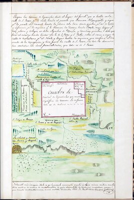
"Copy of the geographical map that shows the ancient site of Mexico"
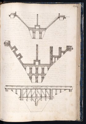
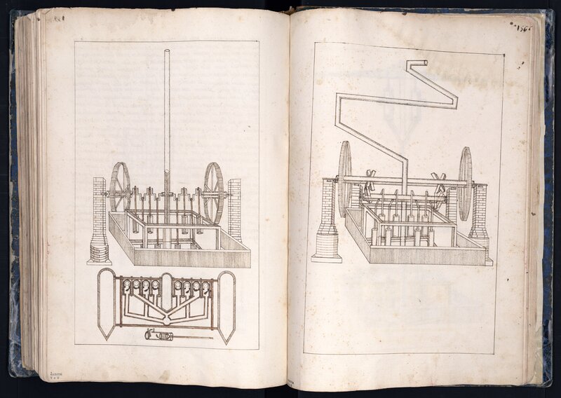
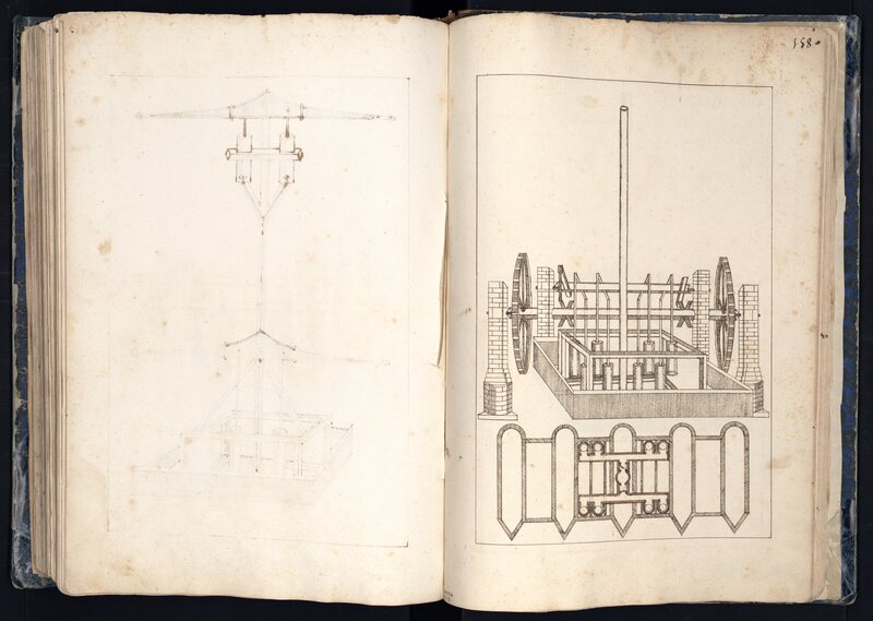
Aqueduct designs
Surrounded by lake waters, Tenochtitlán was a perfect example of geographic adaptation, modification, and dependence. Throughout the fourteenth and fifteenth century, the Mexica "grew" the islet through land reclamation. The Indigenous communities that settled in the Valley of Mexico understood that "floods were a precondition for a large part of the basin's agricultural productivity" (Candiani, 5). Taking advantage of the abundance of water, they built chinampas, or floating agricultural islands, in the southern part of the basin—specifically in the Xochimilco and Chalco lakes—to feed its population.
The Mexica also leveraged the vast water resource for other needs. The lakes provided fish and waterfowl as additional food sources and facilitated importation of goods between city-states along the coast and Tenochtitlán through canoe transportation. A certain number of causeways connected the islet to the mainland, limiting access early on to enemy communities such as Teztcoco and Azcapotzalco. These roads also supported aqueducts, which transported spring water for drinking and irrigation, and met at the ceremonial center of the Aztec empire.
"Plan for a city of Spaniards"
After the Europeans overtook Tenochtitlán in 1521, they destroyed the ceremonial architecture that occupied its urban core to create their "Venice of the Western world" (Prescott, 9). They quickly delineated the spatial boundaries for the "city of Spaniards", relegating the Indigenous communities to the islet's periphery. However, through the decades, the Spanish would continue to displace the Natives and claim their land as they concentrated power and wealth in the new viceregal capital—Mexico City.
Spanish elites considered the Valley of Mexico's seasonal flooding an economic threat: inundations were destroying properties and affecting rent revenues (Candiani, 5). As early as 1555, viceroys commissioned hydrological studies and projects, such as dams, pools, and levees, to channel lake water outside of the basin. In 1607, the royal government initiated perhaps one of its largest projects. Under the direction of royal cosmographer and printer Enrico Martinez, Indigenous and enslaved African laborers bored a tunnel through the mountainous region connecting Lake Zumpango and Huehuetoca to redirect the lake waters. However, landslides eventually blocked the channel. Despite the failure, Martinez would continue to lead these drainage efforts for more than two decades.
After Martinez's death in 1632, a rival engineer—Carmelite Friar Andrés de San Miguel—would champion and lead a different approach to draining the valley. The friar had extensive knowledge in hydrology and actively designed pumps that would move water from lower altitudes to higher, and vice versa, in order to keep the capital city dry. Leveraging the work that had been done, Fr. San Miguel proposed transforming the tunnel into an open trench to better deal with obstructions. Despite multiple attempts to control the environment, including the nearly complete drainage of the Valley of Mexico's lakes, flooding persisted in Mexico City well into the nineteenth century.


Bibliography
UT Catalog | Worldcat | Knight, Alan. Mexico: From the Beginning to the Spanish Conquest. New York: Cambridge University Press, 2002.
UT Catalog | Worldcat | Nemser, Daniel. Infrastructures of Race: Concentration and Biopolitics in Colonial Mexico. Austin, TX: University of Texas Press, 2018.
UT Catalog | Worldcat | Prescott, William Hickling. History of the Conquest of Mexico. Philadelphia: J.B. Lippincott, 1873.
UT Catalog | Worldcat | Rubio Mañé, J. Ignacio. El virreinato. México: Instituto de Investigaciones Históricas, UNAM, 1983.